Trail Walking La Tour - Route M 2205 B - Village de Tournefort  - Photo

Route M 2205 B - Village de Tournefort

© OpenStreetMap contributors
Length
Length
4.6 km
Max alt
Max alt
522 m
Uphill gradient
Uphill gradient
282 m
Km-Effort
Km-Effort  
8.4 km
Min alt
Min alt
245 m
Downhill gradient
Downhill gradient
284 m
Boucle
Boucle
Yes
Creation date :
2022-01-17 09:37:04.919
Updated on :
2022-06-30 17:18:09.645

(0 Reviews)

Walking
Walking
2h57
Difficulty : Medium

Scan this QR Code to open this trail in the SityTrail application

FREE GPS app for hiking

Logo SityTrail SityTrail

IGN / Geographical institutes

Download SityTrail from the App Store Download SityTrail from Google Play

Logo SityTrail SityTrail World

The world is yours!

Download SityTrail from the App Store Download SityTrail from Google Play Download SityTrail on Huawei AppGallery

About

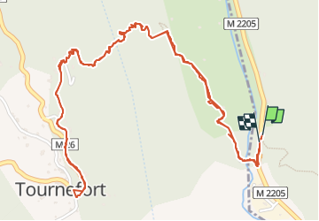
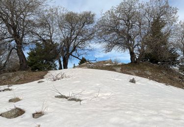
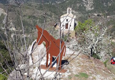
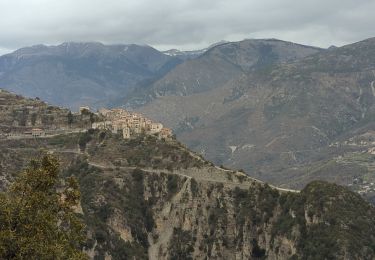
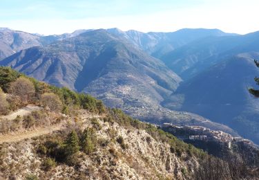
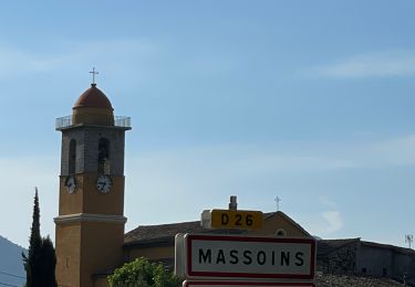
Trail Walking of 4.6 km to be discovered at Provence-Alpes-Côte d'Azur, Maritime Alps, La Tour. This trail is proposed by clarambre.

Description

Je me suis garée, au pied de la Borne , un emplacement qui fait office de parking, pouvant recevoir 3 voitures.
La traversée de la route M 2205 à ce niveau est assez dangereuse car aucune visibilité.

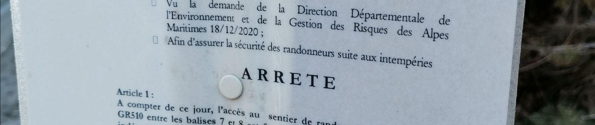
Le balisage n'était pas récent, je l'ai ravivé et installé à de nombreux endroits.
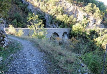
Passage difficile juste après le Centre lorsque l'on doit passer un cour d'eau.
J'ai aussi beaucoup nettoyé le chemin, heureusement j'étais avec Marie, une toute nouvelle baliseuse. (photo avant, après).

Elevation profile

Photos

Positioning

Country:
France
Region :
Provence-Alpes-Côte d'Azur
Department/Province :
Maritime Alps
Municipality :
La Tour
Location:
Unknown
Start:(UTM)
352378 ; 4867840 (32T) N.

Trails nearby

Trail On foot La Tour - Circuit de Mangiarde - Photo
On foot
PRO

On foot

Medium
La Tour, Provence-Alpes-Côte d'Azur, Maritime Alps, France
12.7 km | 25 km-effort
5h 36min
Yes
Trail On foot Bairols - Tour du mont Falourde - Photo
On foot
PRO

On foot

Medium
Bairols, Provence-Alpes-Côte d'Azur, Maritime Alps, France
16.5 km | 31 km-effort
6h 58min
Yes
Trail On foot Massoins - Plateau du Lac - Photo
On foot
PRO

On foot

Medium
Massoins, Provence-Alpes-Côte d'Azur, Maritime Alps, France
10.7 km | 22 km-effort
4h 54min
Yes
Trail Walking Bairols - Pointe des 4 Cantons  - Photo
Walking
bozo1970

Walking

Very difficult
Bairols, Provence-Alpes-Côte d'Azur, Maritime Alps, France
12.2 km | 25 km-effort
5h 45min
Yes
Trail Walking La Tour - Pic charvet, son Fort, Chapelle St Antoine, Tournefort - Photo
Walking
GrouGary

Walking

Easy
La Tour, Provence-Alpes-Côte d'Azur, Maritime Alps, France
12.8 km | 23 km-effort
5h 10min
Yes
Trail Walking Bairols - Mont Falourde depuis Bairoldmd - Photo
Walking
patsure

Walking

Medium
Bairols, Provence-Alpes-Côte d'Azur, Maritime Alps, France
12.7 km | 22 km-effort
4h 3min
Yes
Trail Walking Bairols - Pointe des 4 cantons de Bairols retour col de l'espella - Photo
Walking
GrouGary

Walking

Difficult
Bairols, Provence-Alpes-Côte d'Azur, Maritime Alps, France
14.7 km | 29 km-effort
4h 43min
Yes
Trail Walking Malaussène - Malaussene : Le Canal de l'Adous - Photo
Walking
jlrayon

Walking

Medium
Malaussène, Provence-Alpes-Côte d'Azur, Maritime Alps, France
8.8 km | 11.8 km-effort
3h 59min
Yes
Trail Walking Massoins - Pointe des 4 cantons - Photo
Walking
ETMU5496

Walking

Very difficult
Massoins, Provence-Alpes-Côte d'Azur, Maritime Alps, France
23 km | 43 km-effort
6h 12min
Yes


Close
My subscriptions